
About Broward County Florida
Broward County Florida Map some Most Important Information About Broward County Florida
Broward
- Total Parcels
786,481
- Population
2.04 Million
- Municipalities
Total 31
- County Area
1,323 Sqm
- Home Price
$426,500
Download Map In PDF Formate
Download Broward County Zoning Map, ZipCode Map And Google Map In Pdf For Persnol or Property Use.
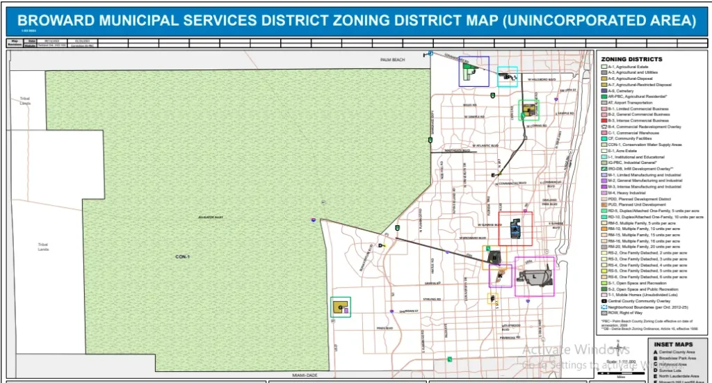
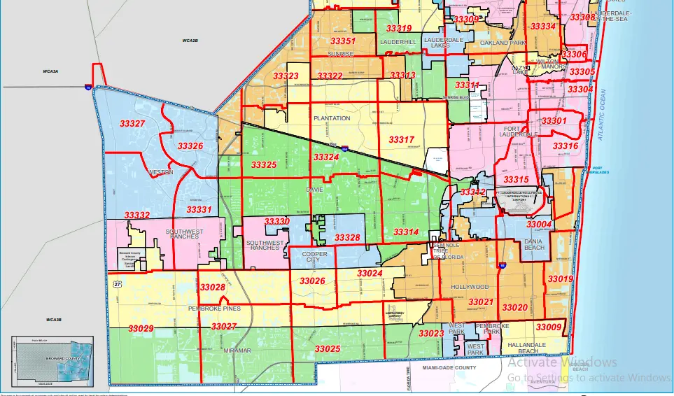
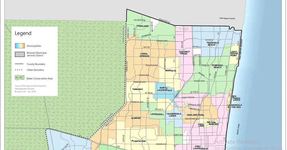
Broward County Cities Population and Growth Overview
This table highlights the latest population, growth rate, density, and city type for all major Broward County municipalities, helping users quickly compare updated demographic trends and local development patterns.
| Rank | City / Town | Population | Previous | Growth | Density | Area (sq mi) | Type |
|---|---|---|---|---|---|---|---|
| 1 | Fort Lauderdale | 194,579 | 182,765 | 1.02% | 5,627 | 35 | City |
| 2 | Pembroke Pines | 183,446 | 171,086 | 1.14% | 5,613 | 33 | City |
| 3 | Hollywood | 162,199 | 152,820 | 0.97% | 5,952 | 27 | City |
| 4 | Miramar | 147,600 | 134,525 | 1.50% | 5,116 | 29 | City |
| 5 | Coral Springs | 144,121 | 134,182 | 1.16% | 6,303 | 23 | City |
| 6 | Pompano Beach | 121,174 | 111,964 | 1.28% | 5,035 | 24 | City |
| 7 | Davie | 115,062 | 106,032 | 1.33% | 3,297 | 35 | Town |
| 8 | Plantation | 104,997 | 92,088 | 2.09% | 4,827 | 22 | City |
| 9 | Sunrise | 101,643 | 97,097 | 0.75% | 6,275 | 16 | City |
| 10 | Deerfield Beach | 92,373 | 86,775 | 1.02% | 6,175 | 15 | City |
| 11 | Lauderhill | 77,773 | 74,335 | 0.74% | 9,133 | 9 | City |
| 12 | Tamarac | 76,763 | 71,914 | 1.06% | 6,621 | 12 | City |
| 13 | Weston | 72,007 | 68,008 | 0.93% | 2,928 | 25 | City |
| 14 | Margate | 61,671 | 58,607 | 0.84% | 7,040 | 9 | City |
| 15 | Coconut Creek | 60,718 | 57,727 | 0.83% | 5,433 | 11 | City |
| 16 | North Lauderdale | 47,141 | 44,723 | 0.86% | 10,199 | 5 | City |
| 17 | Oakland Park | 46,538 | 44,237 | 0.83% | 6,206 | 7 | City |
| 18 | Hallandale Beach | 44,001 | 41,127 | 1.10% | 10,447 | 4 | City |
| 19 | Parkland | 42,094 | 34,911 | 2.93% | 3,352 | 13 | City |
| 20 | Lauderdale Lakes | 37,972 | 36,054 | 0.85% | 10,316 | 4 | City |
| 21 | Cooper City | 36,144 | 34,334 | 0.84% | 4,497 | 8 | City |
| 22 | Dania Beach | 33,749 | 31,730 | 1.01% | 4,307 | 8 | City |
| 23 | West Park | 15,910 | 15,102 | 0.86% | 7,238 | 2 | City |
| 24 | Wilton Manors | 11,964 | 11,436 | 0.74% | 6,073 | 2 | City |
| 25 | Lighthouse Point | 11,082 | 10,469 | 0.93% | 4,804 | 2 | City |
Find Area in Interactive Google Map
Find any location easily using an interactive Google Map. Zoom in, explore nearby places, and get accurate boundaries and details for better understanding of areas, routes, and property locations online.
Broward County Detailed Statistics Overview
This overview provides complete statistical information about Broward County, including population, land and water area, number of cities, property values, and tax rates. It helps users easily understand key geographic, demographic, and real estate data in a simple and structured format for better analysis and decision-making.
| County Name | Broward County |
| County Seat | Fort Lauderdale |
| State | Florida |
| Population | 2.04 Million |
| Total Parcels | 786,481 |
| Total Area | 1,323 sq miles |
| Land Area | 1,210 sq miles |
| Water Area | 113 sq miles |
| Number of Cities | 31 Municipalities |
| Median Home Price | $426,500 |
| Median Household Income | Approx. $68,000 |
| Property Tax Rate | 1.02% |
| Effective Tax Rate | 0.98% |
| Coordinates | 26.1901° N, 80.3659° W |
| Time Zone | Eastern Time (ET) |
| FIPS Code | 12-011 |
| Adjacent Counties | Palm Beach, Miami-Dade, Collier, Hendry |
| Major Cities | Fort Lauderdale, Hollywood, Pembroke Pines |
| Highways | I-95, I-75, I-595, US-1, US-27 |
| Landmarks | Sawgrass Mills, Fort Lauderdale Beach |
How can I use the Broward County map on this page?
You can zoom in, zoom out, and explore different areas of Broward County using the interactive map to find locations, boundaries, and nearby places easily.
Does this map show property boundaries in Broward County?
Yes, the map helps you understand general property locations and boundaries, making it easier to identify parcels and nearby surroundings.
Can I search a specific address on this Broward County map?
Yes, you can enter any address or location and the interactive map will help you find it quickly within Broward County.
Is this Broward County map updated regularly?
Yes, the map data is based on updated geographic and property information to provide accurate location details and boundaries.
Can I download the Broward County map from this page?
Yes, you can download the Broward County map in PDF format for offline use, property study, or personal reference.